
How MIT’s Lidar Solution Could Revolutionize Autonomous Technology and More
“`html
In a significant breakthrough that has the potential to reshape various industries, engineers at the Massachusetts Institute of Technology (MIT) have addressed a long-standing problem in lidar technology—a tool critical for autonomous vehicles, robotics, and mapping. The implications of this MIT lidar solution extend beyond just technical specifications; they touch upon safety, surveillance, and the future of transportation. This article dives deep into the details of this breakthrough, the challenges faced by researchers, and the broader impact that this advancement could have across multiple sectors.
Understanding Lidar and Its Importance
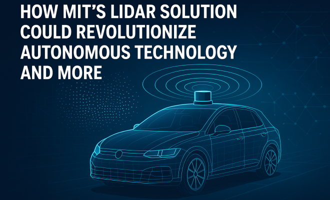
Lidar, which stands for Light Detection and Ranging, utilizes laser light to measure distances. The technology sends out pulses of light and calculates how long it takes for them to bounce back from objects, thus creating detailed 3D representations of surroundings. Lidar systems have become a cornerstone for applications involving autonomous driving, robotics, environmental monitoring, and even defense strategy.
The ability of lidar to accurately and rapidly map environments is a game-changer, especially for self-driving cars which rely on real-time data to navigate safely. However, like many advanced technologies, lidar has its challenges. Factors such as weather conditions, cost, and data processing speeds have historically limited its widespread adoption.
The Challenge: Years of Frustration
Despite its potential, the lidar industry has faced significant hurdles over the years. One major issue has been the cost of high-quality lidar systems, which have often been prohibitively expensive. Additionally, many lidar sensors struggle to perform optimally in adverse weather conditions such as heavy rain or fog, which can dramatically affect their performance.
Engineers have also grappled with the challenge of integrating lidar technology with other sensors to create a cohesive system that can reliably function in various environments. These persistent issues have left many researchers feeling frustrated, as the promise of lidar technology has often been overshadowed by these limitations.
The MIT Lidar Solution: A Breakthrough Unveiled
The recent breakthrough from MIT engineers centers around a novel approach that significantly enhances the performance of lidar systems. By leveraging advanced algorithms and innovative hardware configurations, researchers have tackled some of the core issues that have plagued lidar technology for years.
This MIT lidar solution promises not only increased accuracy in distance measurements but also improved resilience against weather-related disruptions. The technology has been designed to operate effectively in challenging scenarios where traditional lidar systems would falter, marking a critical turning point that could enable broader adoption across various industries.
Technical Mechanisms Behind the Breakthrough
At the heart of this breakthrough lies a sophisticated data processing strategy. The engineers have developed algorithms capable of interpreting lidar data more effectively, allowing for faster and more accurate mapping of environments. The new hardware configurations also play a crucial role, as they facilitate the collection of data across a wider range of conditions.
By optimizing both the software and hardware sides, MIT’s engineers have managed to create a system that not only collects data with greater precision but does so in real time. This advancement is particularly relevant for autonomous vehicles, which require immediate feedback from their surroundings to make safe driving decisions.
Potential Applications Across Multiple Industries
The implications of the MIT lidar solution extend well beyond self-driving cars. In the field of robotics, enhanced lidar technology can lead to improved navigation systems, enabling robots to operate more effectively in dynamic environments such as warehouses or construction sites.
In addition, this advancement has the potential to impact sectors such as urban planning and environmental monitoring. Accurate mapping technologies can aid city planners in designing smarter, more efficient urban spaces, while environmental researchers can use improved lidar systems to monitor changes in ecosystems more effectively. (See: Massachusetts Institute of Technology.)
The Impact on Autonomous Vehicles
For the automotive industry, the introduction of an effective lidar solution could pivotally change the landscape of autonomous driving. The capacity for improved data processing means that vehicles can not only recognize their surroundings better but also anticipate potential hazards with greater accuracy.
This could significantly enhance safety features in autonomous vehicles. As the technology matures, it may lead to the deployment of self-driving cars that are far more capable of navigating complex urban environments, which are often fraught with challenges such as pedestrians, cyclists, and unpredictable traffic patterns.
Broader Implications for Society
The societal implications of the MIT lidar solution are profound. As lidar technology becomes more accessible and effective, it could lead to a shift in how cities are structured and how people interact with their environments. For instance, enhanced mapping capabilities can facilitate more sustainable urban development, allowing city planners to create greener spaces and improve public transportation systems.
Moreover, advancements in lidar technology could bolster security measures. Enhanced surveillance capabilities could be employed in public safety applications, helping law enforcement agencies monitor crowded venues or public events with greater efficacy.
Expert Perspectives on the Breakthrough
Industry experts have weighed in on the significance of the MIT lidar solution. Many believe that this breakthrough could accelerate the timeline for widespread adoption of autonomous vehicles. Dr. Jane Holloway, a leading researcher in autonomous systems, commented on the breakthrough, stating, “This advancement could significantly reduce the barriers to entry for companies looking to develop or enhance autonomous technologies. It’s an exciting time for the industry.”
Furthermore, experts have noted that the collaboration between different fields is vital for the ongoing evolution of lidar technology. By integrating perspectives from engineering, computer science, and urban planning, researchers can create more holistic solutions that address the multifaceted challenges associated with the deployment of advanced technologies.
Challenges Ahead: Integration and Adoption
Despite the promising nature of the MIT lidar solution, several challenges remain. For one, companies will need to integrate this new technology into their existing systems. This requires not only technical adjustments but also comprehensive training for personnel tasked with operating and maintaining these advanced systems.
Moreover, as lidar technology becomes more prevalent, ethical considerations surrounding privacy and surveillance will inevitably come to the forefront. Stakeholders must navigate these complex issues to ensure that the benefits of lidar advancements do not come at the expense of individual privacy rights.
Looking Forward: The Future of Lidar Technology
The breakthrough presented by MIT engineers marks a significant step forward in lidar technology, but it is just the beginning. As researchers continue to refine their approaches and applications, the future holds exciting potential. Innovations in lidar technology could unlock new applications across various fields, from healthcare to infrastructure management.
As we stand on the cusp of this technological revolution, it is essential for all stakeholders—engineers, policymakers, and the public—to engage in conversations about how to harness these advancements responsibly. The potential for enhanced safety, efficiency, and sustainability is enormous, but it must be balanced with ethical considerations and public interests.
Case Studies: Real-World Applications of Lidar Technology
To understand the practical implications of the MIT lidar solution, examining real-world case studies reveals the transformative power of lidar technology. For example, companies like Waymo and Tesla have already begun integrating lidar systems into their autonomous driving algorithms, leading to significant improvements in navigation accuracy and safety. In urban environments, cities like San Francisco and Singapore have utilized lidar for smart city initiatives, mapping and analyzing urban growth and infrastructure needs.
Moreover, in the field of environmental conservation, researchers have used advanced lidar systems to monitor deforestation in the Amazon rainforest, allowing for more effective conservation strategies. This type of application not only demonstrates the versatility of lidar technology but also highlights its potential in addressing global challenges. (See: New York Times.)
Statistics: The Growth of the Lidar Market
The lidar market is projected to experience significant growth in the coming years. According to industry analysis, the global lidar market size was valued at approximately $1.1 billion in 2020 and is expected to expand at a compound annual growth rate (CAGR) of about 25% from 2021 to 2028. This surge is primarily driven by increased demand for lidar systems in areas such as autonomous vehicles, infrastructure development, and geographical mapping.
Furthermore, advancements in technology, such as the MIT lidar solution, are expected to lower costs and improve accessibility, fueling broader adoption across various sectors. The integration of lidar technology in drones for surveying and mapping is also on the rise, with applications spanning agriculture, mining, and real estate.
Frequently Asked Questions (FAQ)
What is lidar technology and how does it work?
Lidar technology uses laser light to measure distances and create detailed 3D maps of environments. It emits pulses of light and measures the time it takes for those pulses to return, providing precise distance measurements and enabling real-time mapping.
How does the MIT lidar solution improve upon existing lidar technology?
The MIT lidar solution incorporates advanced algorithms and innovative hardware configurations that enhance the accuracy and speed of data collection and processing. This improvement allows lidar systems to function effectively in adverse weather conditions and other challenging scenarios.
What are the potential applications of the MIT lidar solution?
The MIT lidar solution has a wide range of applications, including autonomous vehicles, robotics, urban planning, environmental monitoring, and even public safety. Its enhanced capabilities can lead to more efficient and effective systems across various industries.
What are the challenges associated with integrating lidar technology?
Challenges include the high cost of implementation, the need for technical adjustments in existing systems, and the requirement for comprehensive training for personnel handling the technology. Additionally, ethical considerations regarding privacy and surveillance must be addressed.
What does the future hold for lidar technology?
The future of lidar technology looks promising, with significant growth anticipated in various sectors. As advancements continue, we can expect to see more widespread adoption, lower costs, and new applications emerging in fields such as healthcare, agriculture, and urban planning.
Comparison with Other Technologies
When discussing the MIT lidar solution, it is essential to compare lidar technology with other distance measurement and mapping technologies, such as RADAR and SONAR. While each of these technologies has its strengths and weaknesses, they are typically suited for different applications and environments.
One major advantage of lidar over RADAR is its ability to provide higher resolution data. Lidar uses laser light, which has a shorter wavelength than the radio waves used by RADAR, allowing it to capture finer details in the environment. This makes lidar particularly effective for applications that require high precision, such as topographic mapping and vegetation analysis.
Conversely, RADAR is often more effective in adverse weather conditions, such as heavy rain or fog. This resilience makes RADAR a preferred choice for aviation and maritime applications, where visibility can be significantly compromised. In contrast, SONAR, which uses sound waves to detect objects underwater, may be the go-to technology for underwater mapping and exploration. (See: ScienceDirect on Lidar Technology.)
Ultimately, the MIT lidar solution embodies the potential of lidar technologies to address specific challenges, providing an innovative alternative to these established methods in various contexts.
The Economic Impact of Lidar Technology
The economic impact of the MIT lidar solution extends across multiple sectors. In the automotive industry, for instance, the successful integration of more affordable and effective lidar systems could significantly reduce costs for manufacturers and consumers alike. The resulting decrease in vehicle production costs may lead to lower prices for consumers, accelerating the adoption of electric and autonomous vehicles.
Additionally, in the construction and urban planning sectors, enhanced lidar capabilities can streamline project workflows. For example, companies can create detailed 3D models of construction sites, allowing for better planning and resource allocation. This level of precision can reduce material waste and improve project timelines, ultimately leading to cost savings.
In the agricultural sector, farmers can utilize advanced lidar technology to monitor crop health and optimize irrigation practices. A study from the University of Minnesota found that precision agriculture techniques, including lidar mapping, can increase crop yields by up to 20% while simultaneously reducing resource usage. This not only enhances economic returns for farmers but also contributes to sustainable farming practices.
The Role of Policy and Regulation in Lidar Adoption
The widespread adoption of lidar technology, including the MIT lidar solution, will also be influenced by policy and regulatory frameworks. As lidar systems become integral to public safety, transportation, and urban planning, governments will need to establish guidelines to ensure ethical usage and protect privacy rights. Regulations may address how data collected by lidar systems can be utilized, shared, or stored to prevent misuse.
Additionally, policymakers will need to consider the implications of deploying lidar systems in public spaces. For instance, the use of lidar for surveillance in urban environments raises questions about public consent and the potential for invasive monitoring. Balancing technological advancement with privacy rights will be a critical challenge for regulators in the coming years.
As stakeholders engage in dialogue regarding lidar’s role in society, it will be essential to involve diverse perspectives, including those of civil rights organizations, urban planners, and technology developers. This collaborative approach will help shape policies that harness the benefits of lidar while addressing societal concerns.
Conclusion
The MIT lidar solution represents a major leap forward in lidar technology, promising to address long-standing challenges that have hindered its adoption. With applications spanning numerous industries and the potential to transform our interactions with technology, this breakthrough is not just a scientific achievement; it is a glimpse into a more connected and intelligent future. As we embrace these advancements, it is crucial to consider their implications carefully, ensuring that we advance toward a future that prioritizes safety, innovation, and ethical responsibility.
“`
Trending Now
Frequently Asked Questions
What is lidar technology and why is it important?
Lidar, or Light Detection and Ranging, uses laser light to measure distances and create detailed 3D maps of environments. It is crucial for applications like autonomous driving, robotics, and environmental monitoring, as it provides real-time data for safe navigation and accurate mapping.
How does MIT's lidar solution improve existing technology?
MIT's lidar solution addresses long-standing issues such as high costs and performance in adverse weather conditions. By enhancing the integration of lidar with other sensors, it aims to create a more reliable and affordable system for various applications, including autonomous vehicles.
What are the challenges facing lidar technology?
Lidar technology faces challenges including high costs, poor performance in bad weather (like rain or fog), and difficulties in data processing speeds. These factors have historically limited its widespread adoption, despite its potential benefits in various industries.
How could lidar technology impact autonomous vehicles?
Lidar technology is essential for autonomous vehicles as it enables them to accurately and rapidly map their surroundings. This real-time data is critical for safe navigation, helping self-driving cars to make informed decisions on the road.
What industries could benefit from advancements in lidar technology?
Advancements in lidar technology could benefit multiple industries, including autonomous transportation, robotics, environmental monitoring, and defense. Improved lidar systems can enhance safety, efficiency, and data accuracy across these sectors.
What’s your take on this? Share your thoughts in the comments below — we read every one.