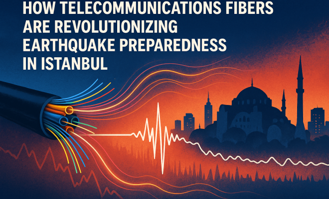
Istanbul’s Earthquake Preparedness: Fiber Optics Revolutionize Seismic Monitorin
“`html
Istanbul, a city that straddles two continents and sits atop a complex tectonic setting, is no stranger to seismic activity. The recent study published in Geophysical Research Letters has unveiled a groundbreaking approach that transforms ordinary telecommunications infrastructure into a sophisticated scientific sensor network. This innovative use of fiber-optic cables for shallow modeling and site amplification in Istanbul significantly enhances our understanding of the subsurface dynamics and seismic risk in this densely populated metropolis.
Understanding the Context: Istanbul’s Seismic Environment
Istanbul is located near the North Anatolian Fault (NAF), one of the most active seismic zones in the world. This fault has a history of producing devastating earthquakes, posing a constant threat to the city and its inhabitants. Thus, the need for accurate seismic models cannot be overstated, as they play a crucial role in urban planning, disaster preparedness, and risk mitigation. The innovative research leveraging existing fiber-optic telecommunications cables offers new insights into how we can better anticipate and respond to potential seismic threats.
The Role of Telecommunications Infrastructure
Telecommunications networks are typically designed for data transmission, but this study highlights their potential as tools for scientific inquiry. The fiber-optic cables, often buried underground and extending across vast areas, can be utilized to create a seismic velocity model of the subsurface. This approach enables researchers to gather crucial information about the geological makeup beneath the city, enhancing our understanding of how seismic waves propagate through different materials.
How Shallow Modeling Works
Shallow modeling involves analyzing the geological layers within the upper 100 meters of the earth’s crust. The study harnesses the principles of seismic wave propagation, which refers to how seismic waves travel through various subsurface materials. By employing the telecommunications fibers as sensors, the researchers could capture seismic data that reflects the characteristics of the underlying geology.
The data collected is then processed to develop a comprehensive model of seismic velocity, which indicates how fast seismic waves travel through different geological formations. This model provides critical insights into site amplification effects—where certain ground conditions can intensify seismic waves, increasing the potential for damage during an earthquake.
Transforming Telecommunications into a Sensor Network
The research team demonstrated that existing telecommunications fibers could be converted into a dense seismic sensor network without requiring extensive new infrastructure. By using advanced algorithms and data processing techniques, the researchers extracted valuable seismic information from the optical signals transmitted through the fiber cables. This innovative approach not only maximizes the use of pre-existing resources but also minimizes the costs and logistical challenges associated with deploying traditional seismic monitoring systems.
Results and Findings
The study revealed significant variations in seismic velocity across different regions of Istanbul, highlighting areas that may experience heightened ground shaking during seismic events. One of the key findings was the identification of shallow sedimentary basins where site amplification effects are pronounced. These findings are particularly relevant for urban planners and emergency response teams, as they can prioritize resources and strategies based on the specific seismic risks faced by different neighborhoods.
Moreover, the research underscored the importance of real-time monitoring. By continuously analyzing the seismic data collected from the telecommunications fibers, it becomes possible to track changes in the subsurface conditions that could indicate increased seismic risk, allowing for more effective disaster preparedness efforts.
Implications for Earthquake Preparedness
In a city like Istanbul, where millions of residents are at risk from potential earthquakes, improving earthquake preparedness is of utmost importance. The innovative use of telecommunications fibers for shallow modeling and site amplification presents several implications for public safety and urban resilience. (See: North Anatolian Fault overview.)
- Enhanced Risk Assessment: With better seismic velocity models, authorities can make informed decisions about zoning regulations, construction standards, and emergency response plans.
- Public Awareness and Education: By communicating the findings to the public, residents can better understand the risks and prepare their homes and communities for potential seismic events.
- Policy Development: Policymakers can utilize this data to develop more effective earthquake response protocols and ensure that infrastructure is designed to withstand seismic forces.
- Resource Allocation: Understanding which areas are at greater risk enables more strategic allocation of resources for emergency services and disaster response.
Challenges and Limitations
While the study marks a significant advancement in using telecommunications infrastructure for seismic monitoring, several challenges and limitations remain. First and foremost, the accuracy of the seismic models depends heavily on the density and quality of the data collected. The existing telecommunications network may not cover all areas equally, potentially leading to gaps in the seismic data.
Moreover, the study relies on the assumption that the behavior of seismic waves in fiber-optic cables accurately reflects their behavior in the surrounding geological materials. Any discrepancies between the two could lead to errors in the seismic velocity model. Ongoing validation and calibration of the models against traditional seismic monitoring data will be crucial to ensure their reliability.
Future Directions for Research
The use of telecommunications fibers in seismic monitoring opens up exciting avenues for future research. One area that warrants further exploration is the integration of additional data sources, such as geophysical surveys and historical seismic records, to enhance the resolution and accuracy of seismic models.
Another promising direction is the development of machine learning algorithms capable of processing vast amounts of seismic data in real time. Such advancements could lead to more precise predictions of ground shaking and potential building performance during seismic events, ultimately improving public safety.
A Broader Impact: Global Implications
The implications of this research extend beyond Istanbul and could be transformative for earthquake-prone regions worldwide. As cities increasingly incorporate technology into their infrastructure, the concept of turning conventional telecommunications networks into scientific sensor arrays can be applied in various contexts.
For instance, urban areas in regions such as California, Japan, and Chile—where the risks of significant seismic events are high—could benefit from similar approaches. By leveraging existing fiber-optic networks, these cities can enhance their earthquake preparedness and response capabilities, ultimately saving lives and reducing economic losses.
The Importance of Community Engagement in Seismic Preparedness
Engaging the community is critical to enhancing earthquake preparedness in Istanbul. Awareness campaigns that incorporate findings from the seismic studies can inform residents about risks specific to their neighborhoods. Educational programs in schools can help cultivate a culture of preparedness from a young age, teaching essential skills such as how to respond during an earthquake and the importance of having an emergency kit.
Moreover, community drills and workshops can provide hands-on experience in disaster response, ensuring that residents are not only aware of the risks but also prepared to act when needed. Partnerships between local governments, NGOs, and community groups can foster a collective sense of responsibility and vigilance, particularly in high-risk areas identified through seismic modeling.
Enhanced Technology: The Future of Seismic Monitoring
As research progresses, the integration of newer technologies such as Artificial Intelligence (AI) and the Internet of Things (IoT) presents exciting opportunities for seismic monitoring. AI can analyze seismic data in real-time, providing predictive insights that traditional methods may overlook. For example, by training AI models on historical earthquake data, researchers can improve the accuracy of predictions for future seismic events.
The IoT can also play a crucial role by incorporating a wider range of sensors into the seismic monitoring framework. These sensors can communicate and share data, creating a more comprehensive and dynamic view of the seismic landscape. This interconnected approach not only enhances data collection but also facilitates quicker responses to seismic threats, allowing emergency services to act with greater efficiency. (See: CDC earthquake preparedness resources.)
FAQs about Shallow Modeling and Site Amplification in Istanbul
What is shallow modeling?
Shallow modeling is an analytical approach that investigates the geological layers within the upper 100 meters of the earth’s crust, focusing on understanding how seismic waves propagate through different materials in that depth range.
How do telecommunications fibers work as seismic sensors?
Telecommunications fibers can detect seismic waves by utilizing changes in light signals as seismic waves pass through the buried cables. This data can be processed to gather information on the subsurface geology and seismic velocity.
What is site amplification?
Site amplification refers to the phenomenon where seismic waves are intensified due to specific ground conditions, such as sedimentary basins or soft soil layers, leading to increased shaking during an earthquake.
Why is real-time monitoring important?
Real-time monitoring allows for continuous data collection and analysis, which can help detect changes in subsurface conditions and provide timely information about increased seismic risk, thereby improving disaster preparedness.
How can the findings of this study benefit urban planning in Istanbul?
The findings can help urban planners make informed decisions regarding construction standards, zoning regulations, and emergency response strategies by identifying areas at greater risk of seismic activity.
What are some potential limitations of using telecommunications fibers for seismic monitoring?
Potential limitations include uneven coverage of the telecommunications network, which might leave gaps in data, and the assumption that seismic behavior in fiber-optic cables accurately reflects the geological materials surrounding them.
Comparative Analysis of Seismic Monitoring Techniques
When discussing the advancements in seismic monitoring, it’s essential to compare traditional methods with modern techniques such as those utilizing telecommunications fibers. Traditional seismic monitoring typically involves deploying seismic sensors and seismographs at strategic locations across a region. While effective, this method can be costly and time-consuming, often requiring extensive infrastructure investment. In contrast, the use of telecommunications fibers presents a more scalable solution.
Telecommunications networks are already in place and can be adapted for seismic monitoring at a fraction of the cost. For instance, a city like Istanbul can leverage its extensive fiber-optic network, which spans hundreds of kilometers, to create a dense array of sensors without the need for additional installations. This adaptability not only lowers costs but also allows for more comprehensive coverage of urban areas, leading to more accurate seismic data.
Additionally, traditional methods often rely on point measurements, which can miss the nuances of localized seismic activity. In contrast, the fiber-optic approach captures continuous data along long stretches of cable, providing a more holistic view of seismic behavior across different terrains. As a result, this method can better identify variations in seismic velocity and site amplification effects in densely populated urban environments. (See: Research on fiber-optic sensors in seismic studies.)
Statistics on Seismic Activity in Istanbul
Understanding the seismic risk in Istanbul requires a look at the statistics surrounding past seismic events. According to the Turkish Disaster and Emergency Management Authority (AFAD), Istanbul is at risk for major earthquakes, with studies suggesting a probability of over 60% for a significant earthquake occurring in the next 30 years. In the past century, the region has experienced numerous significant earthquakes, including the 1999 İzmit earthquake, which had a magnitude of 7.4 and resulted in substantial loss of life and infrastructure damage.
Recent seismic studies indicate that Istanbul’s unique geological makeup, including its proximity to the North Anatolian Fault, contributes to the potential for high-intensity shaking during seismic events. The city’s population density—estimated at over 15 million—further complicates the risk, as many residents live in structures that may not adhere to modern building codes designed to withstand earthquakes.
Connecting Shallow Modeling to Climate Resilience
As cities around the world contend with climate change, integrating shallow modeling techniques with seismic monitoring can enhance overall urban resilience. Cities like Istanbul face not only seismic threats but also environmental challenges such as flooding, landslides, and extreme weather events. By employing advanced seismic modeling and analysis methods, urban planners can better understand the interplay between geological factors and climate-related risks.
For example, site amplification studies can inform decisions about infrastructure placement, particularly in areas vulnerable to both seismic shaking and flooding. Understanding how soft soils react during a seismic event can also guide improvements in drainage systems and other infrastructure to mitigate potential damage. This integrated approach can lead to safer, more resilient urban environments capable of withstanding both seismic and climatic stresses.
Conclusion: A New Era in Seismic Monitoring
The study of shallow modeling and site amplification using telecommunications fibers in Istanbul represents a significant step forward in earthquake research and public safety. By creatively harnessing existing infrastructure, researchers have opened the door to a new era of seismic monitoring that is both cost-effective and efficient.
As urban populations continue to grow and the risks associated with seismic hazards persist, innovative solutions such as this are essential for enhancing resilience and safeguarding communities. The ongoing refinement of seismic models through the integration of telecommunications networks not only enriches our scientific understanding but also empowers cities to better prepare for the inevitable seismic events that lie ahead.
“`
Trending Now
- the complete explanation
- our breakdown of how engadget is leading the charge in technology product reviews
- Why Bitcoin Outflows Are Causing Waves…
- this guide on bitcoin price analysis: is the $73k retreat a temporary dip or a deeper reversal?
- this guide on fbi warns: social engineering attacks targeting law firms are on the rise
Frequently Asked Questions
How are telecommunications fibers used in earthquake preparedness?
Telecommunications fibers are repurposed as sensors to create a seismic velocity model of the subsurface. This innovative approach enhances our understanding of seismic risks by analyzing how seismic waves propagate through different geological materials, ultimately improving earthquake preparedness in areas like Istanbul.
What is shallow modeling in seismic studies?
Shallow modeling refers to the analysis of geological layers within the upper 100 meters of the Earth's crust. This technique helps researchers understand how seismic waves travel through various materials, providing crucial insights into potential seismic threats and improving urban planning and disaster preparedness.
Why is Istanbul at risk for earthquakes?
Istanbul is located near the North Anatolian Fault, one of the world's most active seismic zones. The fault's history of devastating earthquakes poses a constant threat to the city, making accurate seismic modeling essential for disaster preparedness and risk mitigation.
What technology is used to improve seismic risk understanding in Istanbul?
The recent study leverages existing fiber-optic telecommunications cables as a sophisticated sensor network. This technology allows researchers to gather vital information about subsurface dynamics, enhancing the understanding of seismic risk in Istanbul's densely populated environment.
How does fiber-optic technology enhance urban planning in seismic zones?
By utilizing fiber-optic technology for seismic modeling, urban planners can gain insights into the geological makeup beneath cities. This information aids in disaster preparedness and risk mitigation strategies, ensuring that infrastructure is designed to withstand potential seismic events.
Agree or disagree? Drop a comment and tell us what you think.